Title
Cal Poly Vertical Files
Description
Collection of newspaper clippings, photocopies, copies of photographic prints, and other secondary sources which provide information about the history of Cal Poly.
Collection of newspaper clippings, photocopies, copies of photographic prints, and other secondary sources which provide information about the history of Cal Poly.
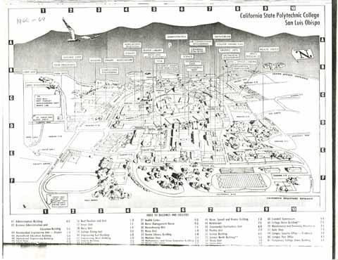
Cal Poly campus map from the 1968-69 school year. The map includes a corresponding index with the names and numbers of the buildings.
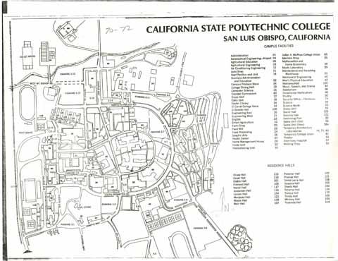
Cal Poly campus map from 1970-1972 school years including an index with the names of buildings and numbers.
Cal Poly campus map circa 1971, including an index with the building names and numbers.
Cal Poly campus map, which includes a 'Directory of facilities,' with the building names and numbers. The map also includes parking information.
Cal Poly campus map circa 1992, which includes a 'Directory of facilities,' with building names and numbers. The map also includes parking information.
A perspective view of the Cal Poly, SLO campus in 1959 with coordinating index including names of buildings. The note on the map reads: 'This perspective map of the Cal Poly campus at San Luis Obispo shows the principal area with respect to instructional facilities - buildings in existence, those under construction, and some that are funded for the near future. The campus comprises about 3,000 acres, including land for agricultural use. The Cal Poly building program is projected for a 10,000 enrollment in 1970 - double that of 1958-1959. As one of California's State Colleges, Cal Poly's instructional program constitutes three divisions - Agriculture, Arts and Sciences, and Engineering. The college is one of the few resident campuses in the State system. It is located about half way between the metropolitan areas of Los Angeles and San Francisco. Other campuses of Cal Poly are located at San Dimas and Pomona.'
![California State Polytechnic College, San Luis Obispo [circa 1971]](/_flysystem/fedora/styles/large/fedora/2023-05/ua-sel_00002735.jpg?itok=BOGsqe9i)
![Cal Poly [campus map, circa 1991]](/_flysystem/fedora/styles/large/fedora/2023-05/ua-sel_00002736.jpg?itok=P6Zwdx5u)
![Cal Poly [campus map, circa 1992]](/_flysystem/fedora/styles/large/fedora/2023-05/ua-sel_00002737.jpg?itok=MpWDw0tO)
![Cal Poly [campus map], 1994](/_flysystem/fedora/styles/large/fedora/2023-05/ua-sel_00002740.jpg?itok=e81fyUxr)


